Budapest Districts: What All 23 Are Actually Like
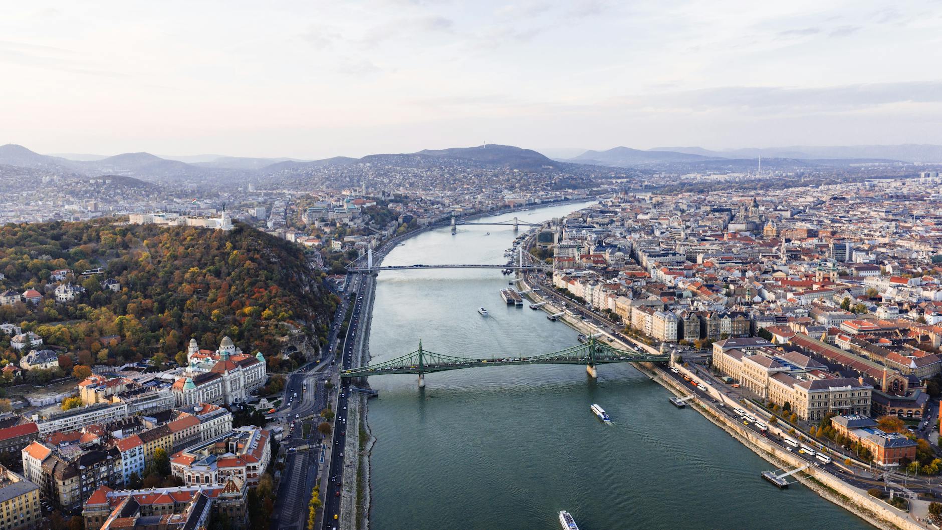
Once you start noticing the Roman numerals, you see them everywhere in Budapest: on the street-name plates at every corner, in every address, in the way locals describe themselves. “The seventh” means the party district, “the fifth” is where the tourists and the ministries are, and “the twelfth” is where the money lives, up in the hills. There are 23 Budapest districts, each with its own mayor, its own character and its own reputation, and between them they range from a baroque hilltop village to a Roman town, a garden city, an island of old steelworks and a hillside full of wine cellars.
This page is a reference to all 23: what each district is like to walk around, what’s there, who lives there, and a little of how it got that way. It isn’t a guide to where to stay. For which district to book a hotel in, see our guide to the best Budapest neighbourhoods to stay in and the where to stay hub. Population and area figures are the 2016 official breakdown, the latest available by district; everything else was checked in September 2026.
How Budapest’s districts work
Budapest as a single city is younger than you might think. Until 1873, Buda on the hills, Óbuda to its north and Pest on the flat eastern bank were three separate towns. When they merged, the new capital was divided into ten numbered districts. More were carved out as the inner city grew, and on 1 January 1950 the biggest change came, when seven neighbouring towns and sixteen villages were absorbed to create Greater Budapest, with nine new districts in one stroke. The twenty-third arrived in 1994, when Soroksár split away from Pesterzsébet.
Each district, or kerület, has its own elected mayor and council, and runs its own schools, parking and a good deal of local life, while the city government handles the things they share, such as public transport and the bridges. You feel the split in small ways: parking rules are set by the city but enforced by the districts, and the character of a street can change the moment you cross a boundary.
Reading the numbers
- Street signs carry the district numeral before the street name, so “VII. Dohány utca” is in District VII.
- Postcodes hide it too: in a Budapest postcode, the second and third digits are the district. 1051 is District V, 1146 is District XIV, 1221 is District XXII.
- Buda or Pest: Districts I, II, III, XI, XII and XXII are in Buda; XXI is on Csepel Island; everything else is in Pest.
- The boundaries in inner Pest follow the old radial roads: Király utca divides VI from VII, Rákóczi út divides VII from VIII, and Üllői út divides VIII from IX.
The names of Pest’s inner districts are a lesson in Habsburg history. Lipótváros is named after Emperor Leopold II, Terézváros after Maria Theresa, Józsefváros after Joseph II, Ferencváros after Francis I and Erzsébetváros after Empress Elisabeth, the much-loved Sisi.
Local shorthand
Budapesters rarely say the full name of a district. They use the number, “the sixth” or “the thirteenth”, or a nickname that carries a whole reputation with it. District VIII is Nyócker, a slangy contraction of nyolcadik kerület, “eighth district”, immortalised in the 2004 animated film of the same name about its multicultural, rough-edged streets. Újlipótváros is simply Újlipót, usually said with affection. Rózsadomb, Rose Hill in District II, has long been shorthand for money and power, and “a villa on Rózsadomb” means much the same as a mansion in Hampstead or on Beverly Hills. And in District IX, Fradi means the football club, not the district, though for many locals there’s little difference.
You’ll also hear people describe the city in rings rather than numbers: belváros for the old centre, “inside the Grand Boulevard” for the dense inner districts, and külváros for the outer suburbs. Where someone lives, in Budapest, still says a lot about who they are.
All 23 districts at a glance
| District | Name | Side | Population (2016) | In a phrase |
|---|---|---|---|---|
| I | Várkerület (Castle District) | Buda | 25,000 | Castle Hill, the palace and the old town |
| II | — | Buda | 90,000 | Leafy hills, villas and Ottoman baths |
| III | Óbuda-Békásmegyer | Buda | 130,000 | Roman ruins, a village square and Sziget |
| IV | Újpest | Pest | 102,000 | Once its own town; football and housing estates |
| V | Belváros-Lipótváros | Pest | 26,000 | Parliament, the Basilica and the historic heart |
| VI | Terézváros | Pest | 39,000 | Andrássy út, the Opera and theatreland |
| VII | Erzsébetváros | Pest | 53,000 | The Jewish Quarter and the ruin bars |
| VIII | Józsefváros | Pest | 77,000 | Palaces, the National Museum and a mixed reputation |
| IX | Ferencváros | Pest | 59,000 | The Great Market Hall, Ráday utca and Fradi |
| X | Kőbánya | Pest | 78,000 | Breweries, cellars and the New Public Cemetery |
| XI | Újbuda | Buda | 152,000 | The biggest district: students, Gellért Hill’s south side |
| XII | Hegyvidék | Buda | 58,000 | The Buda hills, forest and the Children’s Railway |
| XIII | Angyalföld, Újlipótváros, Vizafogó | Pest | 120,000 | 1930s modernism and riverside life |
| XIV | Zugló | Pest | 125,000 | City Park, Heroes’ Square and the Széchenyi Baths |
| XV | Rákospalota, Pestújhely, Újpalota | Pest | 81,000 | Outer suburbs and a big housing estate |
| XVI | Mátyásföld, Sashalom, Cinkota and others | Pest | 73,000 | Garden suburbs of family houses |
| XVII | Rákosmente | Pest | 88,000 | The largest by area, with semi-rural edges |
| XVIII | Pestszentlőrinc-Pestszentimre | Pest | 102,000 | The airport and garden suburbs |
| XIX | Kispest | Pest | 61,000 | The Wekerle garden city |
| XX | Pesterzsébet | Pest | 65,000 | Working-class south Pest |
| XXI | Csepel | Csepel Island | 77,000 | Industrial heritage on the Danube |
| XXII | Budafok-Tétény | Buda | 55,000 | Wine cellars and Memento Park |
| XXIII | Soroksár | Pest | 24,000 | The youngest district, on a quiet arm of the Danube |
Margaret Island, in the middle of the Danube, belongs to none of them: it’s run directly by the city.
Buda and Pest: why the two sides feel different
The Danube is more than a line on the map. Buda, on the west bank, grew up around a royal castle on a hill, with vineyards and villas on the slopes behind it; for centuries it was the seat of kings and then of Habsburg officials, and it has kept a calmer, more residential air. Pest, on the flat eastern plain, was the merchant town, and in the late 19th century it exploded into a modern metropolis of boulevards, apartment blocks, theatres, cafés and factories almost within a single generation.
The split still shows. Roughly seven in ten of the city’s residents live on the Pest side, and so do most of its restaurants, bars, markets and nightlife. Buda has the hills, the castle, most of the old Ottoman baths and a great deal of green space, and its districts include some of the wealthiest in the country. Locals will tell you that Buda is where you live and Pest is where you go out, which is an exaggeration, but only just. The bridges tie the two together, and on a clear evening, standing on any of them, you can see the whole argument at once: palaces and forest on one bank, the Parliament and the city on the other.
The heart of Pest: Districts V, VI, VII, VIII and IX
Five small, dense districts inside and around the Grand Boulevard hold most of what visitors come to Pest for, and most of its nightlife. They’re also where you’ll find the widest gap between tourist Budapest and the city locals live in, sometimes within a single street.
District V: Belváros-Lipótváros
One of the least populated districts, and the grandest by address. Belváros, the Inner City, is old Pest, the medieval walled town, and fragments of its city wall still turn up in courtyards and car parks; the Inner City Parish Church by the Elisabeth Bridge is long known as the city’s oldest church. North of it, Lipótváros was laid out in the 19th century as the city’s financial and political quarter, and it shows: the Parliament, St Stephen’s Basilica, the Academy of Sciences, the banks around Szabadság tér and the Gresham Palace facing the Chain Bridge. Along the river, the Shoes on the Danube memorial is one of the most visited places in the city.
Walking around it, District V feels grand, prosperous and a little impersonal. Váci utca and Vörösmarty tér are tourist Budapest at its most concentrated, and after the offices close on a weekday evening some of Lipótváros goes very quiet. Only around 26,000 people live here, many in large, handsome apartments above the shops.
For the district in more depth, from the two halves of Belváros and Lipótváros to Szabadság tér, Lechner’s Postal Savings Bank and where to eat away from Váci utca, see our District V (Belváros-Lipótváros) guide.
District VI: Terézváros
Terézváros is built around Andrássy út, the tree-lined boulevard from the centre to Heroes’ Square that forms part of the city’s UNESCO World Heritage Site. Along it stand the Hungarian State Opera House, the grand villas of the upper stretch and the House of Terror at number 60. Around the corner, Liszt Ferenc tér has the Liszt Academy concert hall and a row of café terraces, and Nagymező utca, lined with theatres, calls itself Budapest’s Broadway. Nyugati station anchors the district’s northern edge.
It’s more residential than District V, and more lived-in, with a mix of old apartment blocks, grand and shabby by turns, and a lot of bars and restaurants near the border with District VII. It gets quieter and more local the further you walk from Andrássy út.
For the avenue in detail, the M1 beneath it, the Opera and Liszt Academy tours, Nagymező utca and the quieter streets behind, see our guide to District VI.
District VII: Erzsébetváros
Erzsébetváros is the densest district in the city, with about 53,000 people packed into barely two square kilometres, and it has two very different halves. The inner part, between the Small and Grand Boulevards, is the old Jewish Quarter, with the Dohány Street Synagogue, the largest in Europe, and the smaller Rumbach and Kazinczy synagogues. The same streets became the heart of Budapest’s nightlife in the 2000s, when the first ruin bars moved into its crumbling courtyards, and today Kazinczy utca and the Gozsdu passage are packed every weekend night.
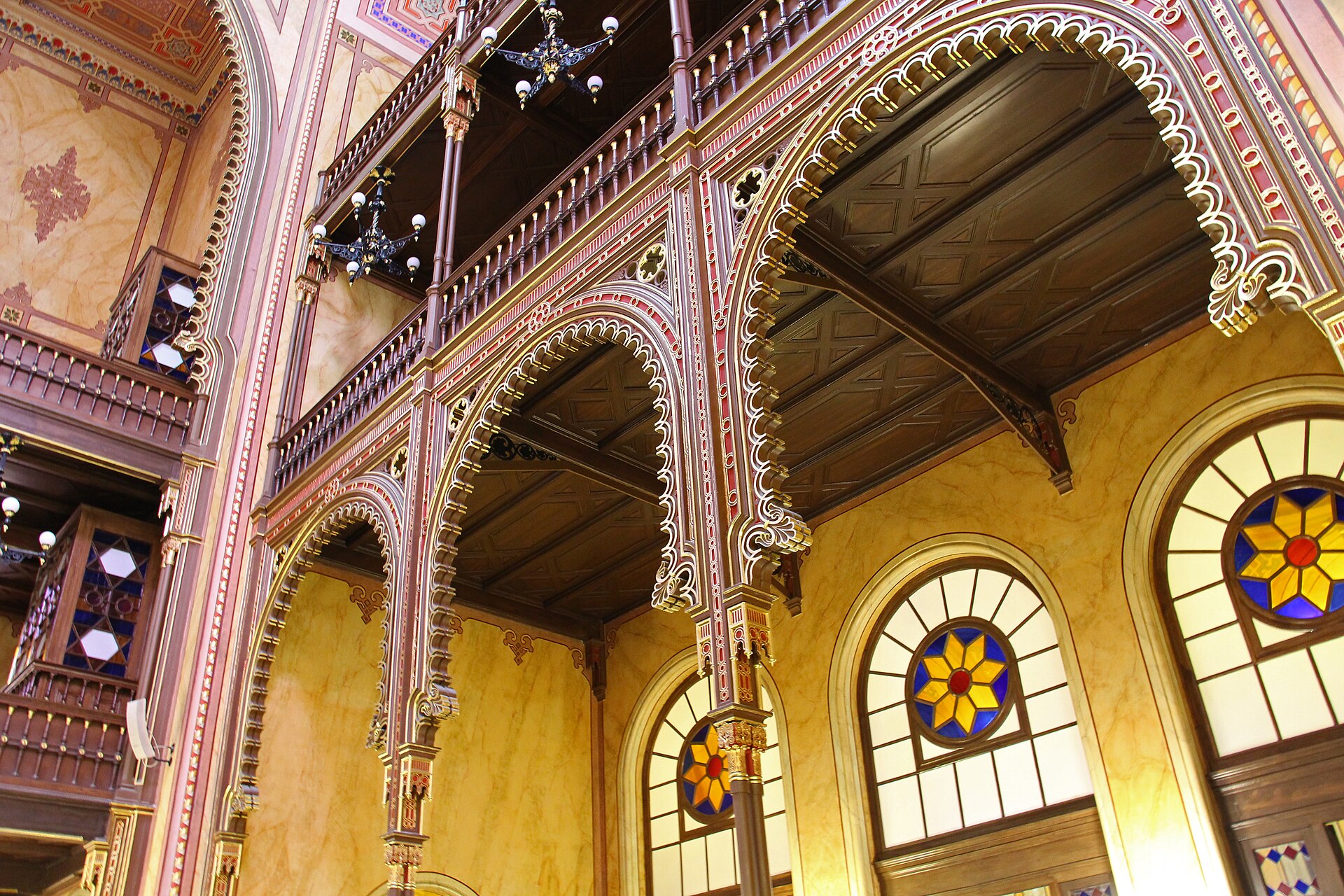
That makes inner District VII the most divided neighbourhood in the city: design shops, kosher bakeries and memorials by day; hen parties and noise complaints by night. Beyond the Grand Boulevard, outer Erzsébetváros is ordinary residential Pest, with none of the fuss.
For what District VII is like to spend time in, from the ruin bars and the 3am noise to the new rules on night venues and short-term lets and the quiet outer district, see our District VII (Erzsébetváros) guide.
District VIII: Józsefváros
Józsefváros has the widest range of any central district. Its inner corner, behind the Hungarian National Museum, is the Palace Quarter, where 19th-century aristocrats built town palaces; the Wenckheim Palace, now a public library, is the finest of them. The district also holds Keleti station, the Rákóczi tér market hall and the Fiumei Road Cemetery, the national pantheon where statesmen, poets and revolutionaries are buried. The Corvin Passage, around the Corvin Cinema, was a centre of fighting in 1956.
Further out, Józsefváros has long had the roughest reputation in the centre, particularly the streets around Mátyás tér, and parts of it are still poor. It’s changing fast, though, with redevelopment around the Corvin Quarter, students from the nearby universities and new cafés moving in. Walk it by day with ordinary big-city awareness and you’ll see a side of Budapest most visitors never reach.
For the Palace Quarter, Corvin köz, the Rákóczi tér market, the Fiumei Road Cemetery and an honest look at safety, see our guide to District VIII.
District IX: Ferencváros
Ferencváros begins at Fővám tér with the Great Market Hall and the university in the old Customs House, and runs south along the river. Ráday utca, a street of restaurants and bars, is its liveliest strip; the Holocaust Memorial Center, in a restored synagogue on Páva utca, is its most important museum; and Ödön Lechner’s Museum of Applied Arts, with its Zsolnay-tiled roof, is one of the landmarks of Budapest Art Nouveau. Further south are the Müpa arts centre and the National Theatre.
It’s also football territory. Ferencváros is home to Fradi, the country’s most successful club, whose green-and-white stadium sits on Üllői út. The district has been steadily rebuilt over the past thirty years, and its middle section, around Tompa utca, is one of the city’s quietly pleasant residential areas.
For Fővám tér and the river, Ráday utca, the Holocaust Memorial Center, the rebuilt middle district and the Müpa riverside, see our guide to District IX.
Buda: Districts I, II, III, XI, XII and XXII
Buda is the hillier, greener, calmer side of the city, with most of its population in comfortable residential districts and most of its visitors on a single hill.
District I: Várkerület, the Castle District
The first district is Castle Hill and the neighbourhoods at its foot, and it’s small, with about 25,000 residents. On top of the hill are the Royal Palace, now home to the Hungarian National Gallery and the Budapest History Museum, the Matthias Church, the Fisherman’s Bastion and the old town’s baroque streets, with the offices of the president and the prime minister among them. Below it, Víziváros, the Watertown, runs along the river to Batthyány tér, with its view of the Parliament across the water; Tabán, once a crowded quarter of fishermen and wine bars, was cleared in the 1930s and is now a park; and Krisztinaváros stretches west towards the hills.
The hilltop is one of the prettiest places in central Europe and, outside the day-tripper hours, one of the quietest: the Castle District is closed to ordinary traffic, and many of its residents are elderly and long-established. The Buda Castle guide covers the sights.
For the district in depth, from the old town’s streets and the Hauszmann reconstructions to Víziváros, Tabán and the cheapest ways up the hill, see our Castle District (District I) guide.
District II
One of the few districts without a name of its own, District II covers north-west Buda from the Danube up into the hills, and it’s one of the wealthiest. Rózsadomb, Rose Hill, is the city’s classic address for villas and embassies, and on its lower slopes is the tomb of Gül Baba, a 16th-century Ottoman dervish, in a small rose garden. The Ottoman-era Lukács Baths stand nearby. Széll Kálmán tér, one of the city’s busiest transport hubs, is on its southern edge, and further out are the villas of Pasarét, the forest at Hűvösvölgy and the hang-gliders’ hill of Hármashatár-hegy.
It feels prosperous, leafy and suburban, the kind of place where Budapest’s professionals raise families, and apart from the baths it has few sights. But a walk up Rózsadomb or out to Hűvösvölgy shows you how much green space the city hides.
District III: Óbuda-Békásmegyer
Óbuda is the oldest part of the city. The Romans built Aquincum here, capital of the province of Pannonia, and you can walk its excavated streets, baths and houses at the Aquincum Museum, and see two Roman amphitheatres elsewhere in the district. Medieval and baroque Óbuda survives around Fő tér, the cobbled main square, and the neighbouring streets, with the Vasarely Museum, the Kiscelli Museum and Imre Varga’s much-photographed bronze women with umbrellas waiting at a street corner.
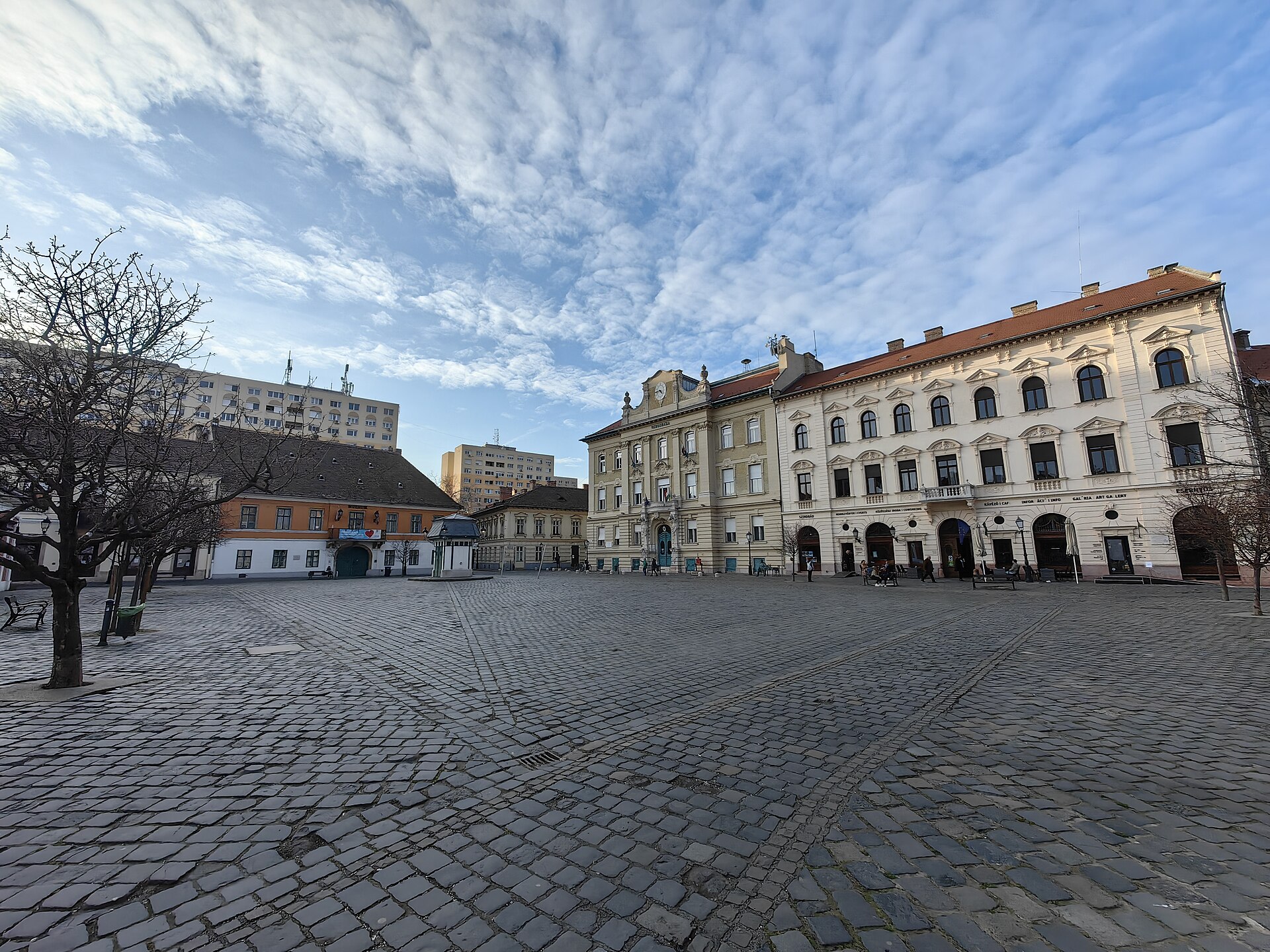
The same view tells you the rest of the story: much of old Óbuda was cleared for enormous housing estates in the 1970s, and Békásmegyer, further north, is one of the largest in the country. In summer the Római-part, the riverbank north of the centre, is lined with lángos stands, beer gardens and cyclists, and Óbuda Island, in the Danube alongside, hosts the Sziget festival every August. The suburban train to Szentendre runs right through the district.
For the full picture, from Aquincum’s winter hours and the military amphitheatre among the flats to Fő tér, the Római-part and the HÉV ride out, see our guide to Óbuda and District III.
District XI: Újbuda
Újbuda is the most populous district in the city, with over 150,000 residents, and it runs from the southern side of Gellért Hill all the way to the city’s south-western edge. At its river end are the Gellért Hotel and the Gellért Baths, closed for a multi-year renovation, the path up to the Citadella, and the Budapest University of Technology, whose students give the district a lot of its energy. Bartók Béla út, running south-west from Szent Gellért tér, has become a strip of cafés, small galleries and wine bars, and the 47 and 49 trams run its length; the tram guide explains the routes.
Beyond Móricz Zsigmond körtér the district becomes a mix of 19th-century streets, the park around the Feneketlen-tó, the so-called Bottomless Lake, and big post-war estates around Kelenföld, where the M4 metro ends. It’s a good example of ordinary, pleasant, lived-in Buda.
District XII: Hegyvidék
Hegyvidék means “hill country”, and it’s the city’s green lung: the Buda hills, with Svábhegy, Normafa and János-hegy, whose summit, at 527 metres, is the highest point in Budapest, topped by the Elisabeth Lookout Tower. The Cogwheel Railway climbs up from Városmajor, the Children’s Railway runs along the ridge, and a chairlift, the Libegő, swings up towards János-hegy from Zugliget. At weekends half the city seems to be up here walking, running or eating strudel at Normafa.
Down below, around the MOM Park shopping centre and Városmajor park, it’s a comfortable, well-off residential district of villas and quiet streets. For families especially, the hills are one of the best days out in the city; Budapest with kids has the details.
The hills above Districts II and XII are a world of their own: forest trails, the cogwheel and Children’s Railway, the Zugliget chairlift and two show caves. Our Buda Hills guide covers how to get up there and what to do.
District XXII: Budafok-Tétény
The southernmost district in Buda has a secret underground. Budafok sits on soft limestone that was quarried for centuries, and the tunnels left behind became wine cellars, many kilometres of them. The Törley sparkling wine house has been producing here since the 19th century, and the district’s cellars host tastings and wine events; the guide to Hungarian wine explains what you’ll be drinking. Nagytétény has a fine baroque mansion, now a museum of historic furniture, and on the district’s edge is Memento Park, where the city’s communist-era statues were sent into exile.
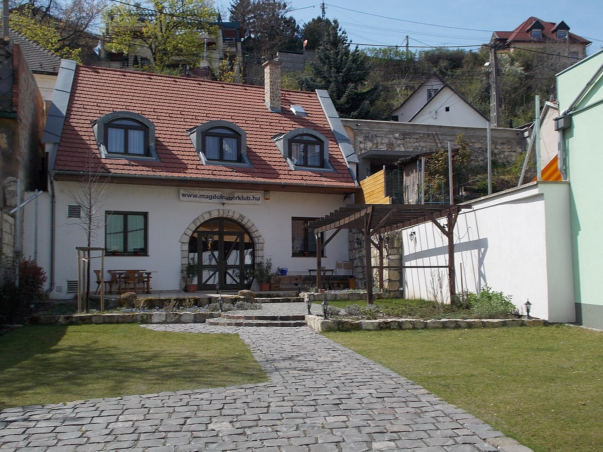
Above ground it’s quiet and suburban, with the feel of a small wine town rather than a capital city. That’s exactly its appeal for an afternoon out.
Beyond the Grand Boulevard: Districts X, XIII and XIV
Three large districts wrap around inner Pest, each with a very different character and at least one reason to visit.
District XIII: Angyalföld, Újlipótváros and Vizafogó
District XIII runs north from the Grand Boulevard along the river, and its southern part, Újlipótváros, is one of the most characterful neighbourhoods in the city. It was built up in the 1930s with modern apartment blocks, many with curving balconies, glass-block stairwells and elegant lobbies, around Pozsonyi út and Szent István Park, and it became home to a large middle-class Jewish community. During 1944 Raoul Wallenberg’s Swedish “protected houses”, which sheltered thousands of Jews from deportation, were concentrated here. Today it’s a café-and-bookshop neighbourhood, much loved by the people who live in it.
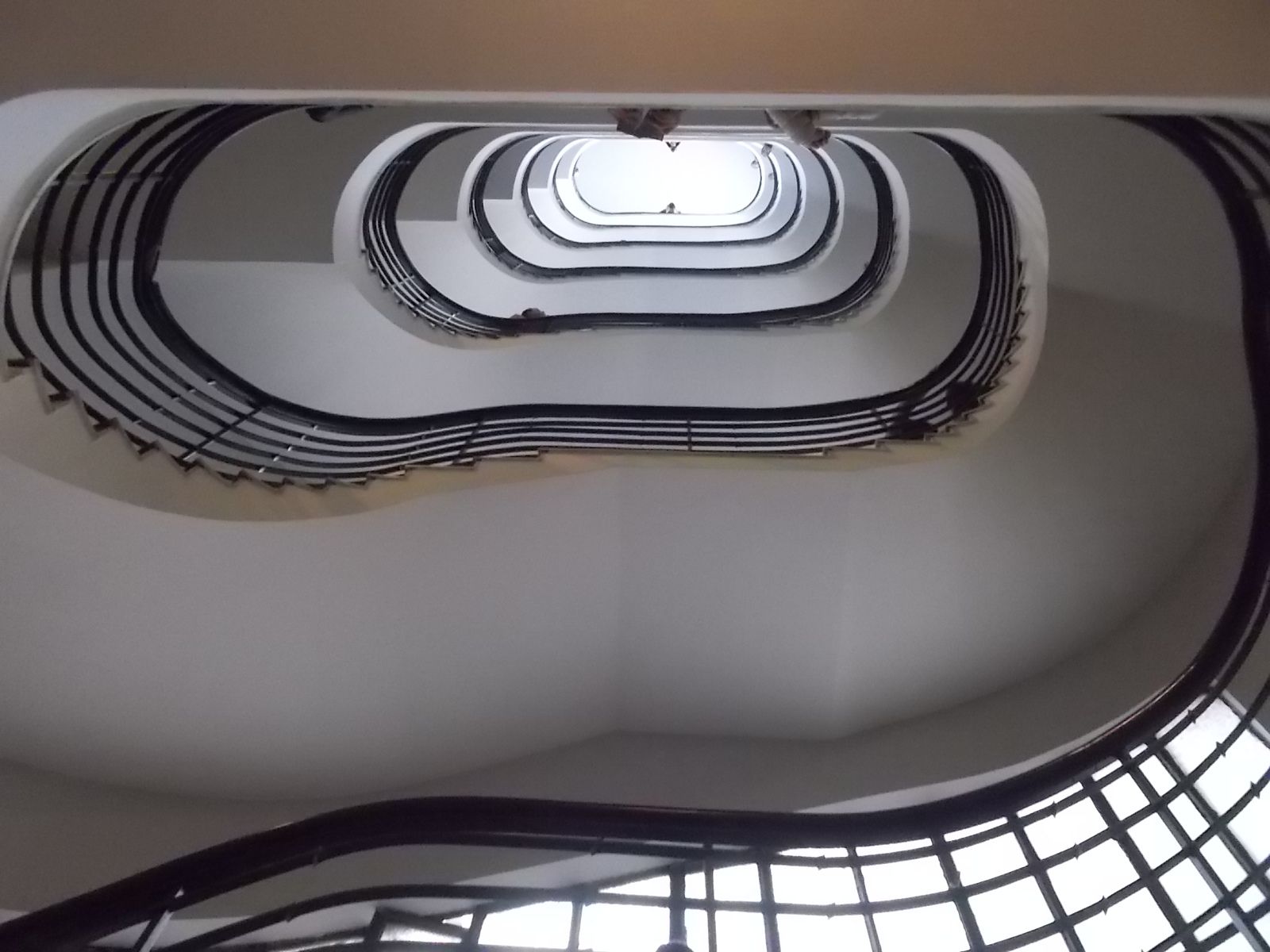
Further north, Angyalföld was historically an industrial, working-class quarter, and Váci út has become the city’s main office corridor. The colourful Lehel market hall is one of the city’s more unusual markets, and the Vígszínház, the Comedy Theatre, is a landmark on the Grand Boulevard. Margaret Island lies just across the water.
For Újlipótváros’s 1930s streets and Szent István park, the protected houses of 1944, the Lehel market, the Dagály baths and how to reach Margaret Island from the district, see our guide to District XIII.
District XIV: Zugló
Zugló is where Budapest goes to play. Its western edge is City Park, the Városliget, laid out in the 19th century and now home to Heroes’ Square, the Museum of Fine Arts, the Széchenyi Baths, the zoo, Vajdahunyad Castle and, since 2022, the House of Music and the new Museum of Ethnography. The national football stadium, the Puskás Aréna, is also in the district.
Beyond the park, Zugló is a big, calm residential district of villas, garden houses and apartment blocks, among the most sought-after places to live in Pest. You’ll walk its streets on the way to and from the baths, and they give you a good sense of comfortable middle-class Budapest.
District X: Kőbánya
Kőbánya means “stone quarry”, and like Budafok it’s riddled with old quarry tunnels, which gave it a brewing industry: Dreher beer has been made here since the 19th century. It’s an industrial and residential district with little conventional sightseeing, but two places deserve a visit. The St Ladislaus Church, by Ödön Lechner, has a roof of glazed Zsolnay tiles. And the New Public Cemetery holds plot 301, where Imre Nagy and other executed leaders of the 1956 revolution were buried in unmarked graves, and reburied with honour in 1989; the guide to communist Budapest explains its significance.
The outer districts: IV, XV–XXI and XXIII
Most of Budapest’s population lives in districts few visitors ever see. Several were separate towns until 1950, and many still have their own old centres, surrounded by family houses, gardens and, in places, large housing estates. They’re not where you’ll spend a holiday, but a couple are worth a special trip.
District IV: Újpest
Újpest, “New Pest”, was an independent industrial town until 1950, and it still has its own centre, its own town hall and its own fiercely supported football club, Újpest FC, which plays in purple. The M3 metro ends here, and beyond it are the housing estates of Káposztásmegyer and the Aquaworld water park. It’s a working city district rather than a destination.
District XV: Rákospalota, Pestújhely and Újpalota
Three communities in one district: Rákospalota, a small town in its own right until 1950 and now a suburb with an old centre; Pestújhely, a garden suburb of family houses; and Újpalota, an estate of prefabricated tower blocks built in the late 1960s and 1970s. It’s residential through and through, with nothing aimed at visitors, but it’s a fair picture of how a great many Budapest families actually live.
District XVI: Mátyásföld, Sashalom, Cinkota and neighbours
A patchwork of garden suburbs on the eastern edge of the city, each a separate village or small town until 1950, with streets of family houses, small shops and a lot of greenery. It’s one of the greenest and most suburban districts in Budapest, with far more gardens than apartment blocks. The suburban train to Gödöllő, with its royal palace, runs through it.
District XVII: Rákosmente
The largest district by area, at nearly 55 square kilometres, and in places the most rural, with old village centres, fields and small farms at its edges. It’s the kind of place that reminds you how much of Budapest is still, in effect, a string of villages.
District XVIII: Pestszentlőrinc-Pestszentimre
Budapest’s airport is here, so most visitors pass through District XVIII without realising it. It’s otherwise a district of garden suburbs and one large 1970s estate. The city’s official weather station is at Pestszentlőrinc too, which is where the averages in our month-by-month guide come from. The airport guide covers the terminal.
District XIX: Kispest
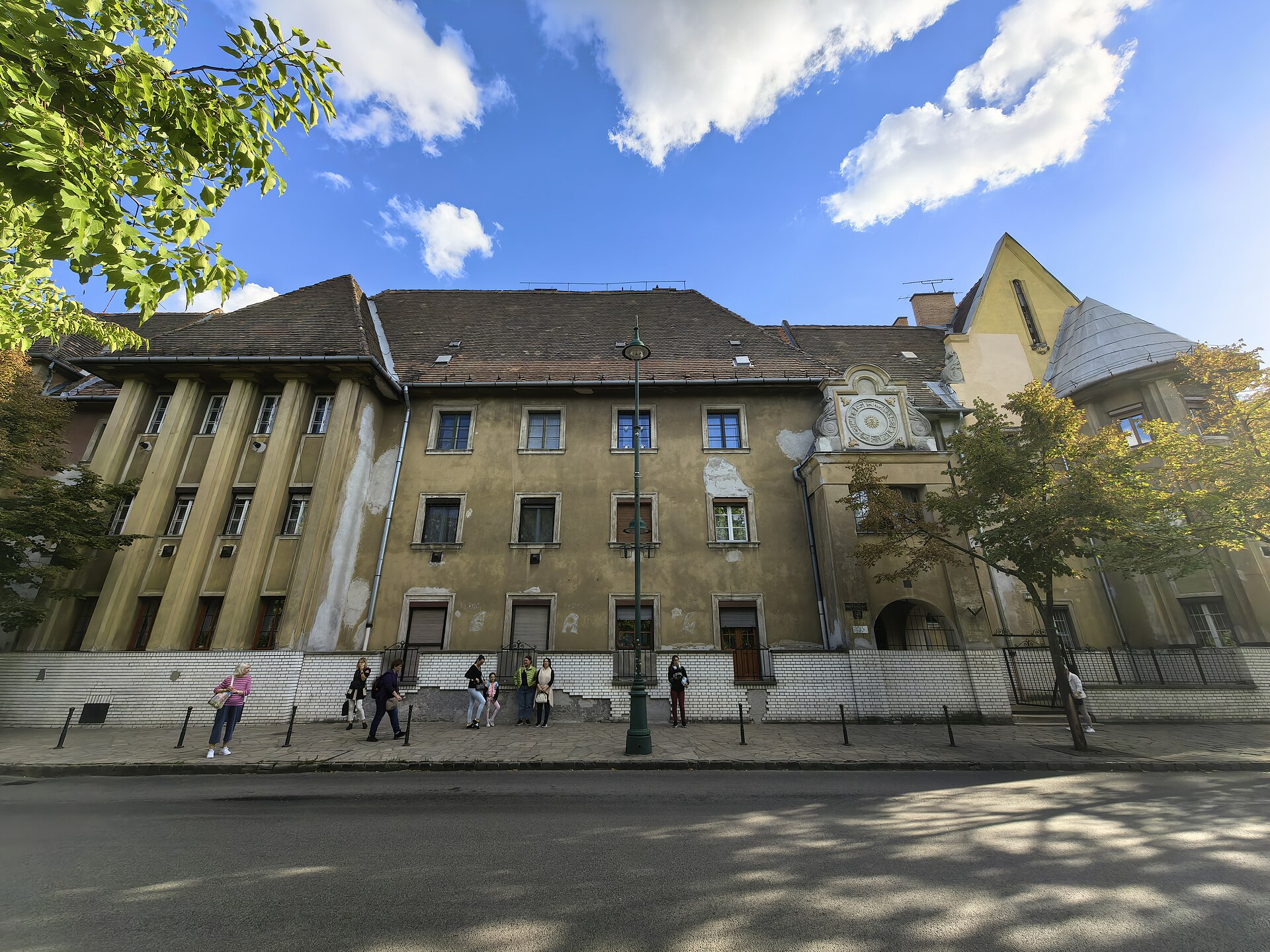
Kispest is the outer district most worth a detour, for one reason: Wekerletelep, the Wekerle estate. Begun in 1908 as housing for workers and named after the prime minister of the day, it’s a planned garden city of cottages and apartment houses in a Hungarian folk-inspired style, built around a central square designed by Károly Kós, with gateways, steep roofs and carved timber. More than a century on, it’s a protected, tree-lined, astonishingly peaceful neighbourhood, and a fascinating counterpoint to the Art Nouveau of the centre. Kispest is also home to the football club Budapest Honvéd.
District XX: Pesterzsébet
Pesterzsébet, also named after Empress Elisabeth, was an independent town until 1950 and is still a mostly working-class district in south Pest, with a busy market, old streets of low houses and a few blocks of flats. The Gubacsi Bridge links it to Csepel across the Soroksár arm of the Danube. Soroksár itself was part of the district until 1994.
District XXI: Csepel
Csepel covers the northern tip of Csepel Island, the long island that runs south from the city in the Danube, and for most of the 20th century it was Hungary’s industrial powerhouse. The vast Weiss Manfréd works made everything from arms to bicycles and motorcycles, and under communism “Red Csepel” was the heart of the working-class city. Much of the old works now stands empty or has been turned over to small businesses and creative spaces. The H7 suburban train runs here from Boráros tér, calling at Közvágóhíd, where the 2 tram ends.
District XXIII: Soroksár
The youngest district, created in 1994, sits on the southern edge of the city beside the Soroksár arm of the Danube, a quiet side channel popular for fishing and boating. It has a history of German-speaking Swabian settlement, a botanical garden, and a small-town feel quite unlike the rest of Budapest. With fewer than 25,000 residents spread over some 40 square kilometres, it’s the one district where the capital genuinely feels like the countryside.
How the districts have changed since 1989
A visitor who last saw Budapest in 1990 would find some districts transformed and others barely touched. The inner districts of Pest, left to crumble through the communist decades, have changed most. In District VII, the empty courtyards of the old Jewish Quarter became the first ruin bars in the early 2000s, and the neighbourhood turned into the city’s nightlife capital, bringing money, restoration and friction with long-term residents in equal measure. The middle of District IX was rebuilt street by street from the 1990s onwards, and the area around the Corvin Cinema in District VIII was redeveloped into a new quarter of offices, flats and a university campus. In District XIV, the Liget Budapest project remade City Park with new museums, completed in 2022 and still argued over for the trees it cost.
At the same time, many better-off families moved up into the Buda hills of Districts II and XII, or out beyond the city limits altogether, and some of the outer Pest districts have aged as a result. The pattern is familiar from other European capitals: a centre increasingly shaped by visitors and newcomers, and a ring of districts where ordinary Budapest life carries on much as before. Both are worth seeing.
Which districts are worth seeing?
Most visitors spend their whole trip in five districts, I, V, VI, VII and IX, with a trip to District XIV for the baths and City Park. That’s no bad thing: they hold most of the sights. But if you have a spare half-day, a few others are genuinely rewarding:
- District III, for Roman Aquincum, Óbuda’s old square and a summer evening on the Római-part.
- District XIII, for an afternoon wandering the 1930s streets of Újlipótváros, with a coffee on Pozsonyi út.
- District XII, for a walk in the Buda hills and the Children’s Railway. The Elisabeth Lookout is closed for renovation.
- District XIX, for the Wekerle estate, one of the most unexpected places in the city.
- District XXII, for a cellar tasting in Budafok and Memento Park on the way back.
- District VIII, for the Palace Quarter and the Fiumei Road Cemetery, a side of central Pest most visitors walk straight past.
For more ideas beyond the obvious, see Budapest’s hidden gems, and for getting to the outer districts, the getting around Budapest hub.
Five districts in a day: a walk across the centre
You can cross five districts on foot in a single unhurried day, and it’s the best way to feel how quickly the city’s character changes. Start in District I on Castle Hill in the morning, before the tour groups arrive, and walk down through the Castle Garden to the river. Cross the Chain Bridge into District V and head through Széchenyi István tér to St Stephen’s Basilica. From there, walk up Andrássy út into District VI as far as the Opera, then cut across to Király utca, the border with District VII, and dive into the Jewish Quarter for lunch. In the afternoon, cross Rákóczi út into District VIII and the quiet streets of the Palace Quarter behind the National Museum, then finish with dinner on Ráday utca in District IX.
That’s about six or seven kilometres, with plenty of stops, and the metro and trams can shortcut any stretch that runs out your legs. It takes you from royal Buda to aristocratic Józsefváros by way of the grandest boulevard in the city and its liveliest quarter, and it’s a better introduction to how Budapest fits together than any bus tour.
Frequently asked questions
How many districts does Budapest have?
Twenty-three, numbered with Roman numerals from I to XXIII. Six are in Buda, one is on Csepel Island, and the other sixteen are in Pest. Margaret Island belongs to none of them and is run by the city.
Which is the best district in Budapest?
It depends on what you want. For sightseeing, District V and District I; for nightlife, District VII; for local character, District XIII’s Újlipótváros or District IX’s Ferencváros; for green space, District XII. For which district to stay in, see our neighbourhood guide for visitors.
What is District VII in Budapest known for?
The historic Jewish Quarter, with the Dohány Street Synagogue, and the ruin bars and nightlife that have grown up in its old courtyards. It’s the densest district in the city, and the liveliest at night.
Which Budapest district is the largest?
By area, District XVII, Rákosmente, at nearly 55 square kilometres. By population, District XI, Újbuda, with over 150,000 residents.
How do I know which district an address is in?
The Roman numeral appears on street signs and in addresses, and the postcode tells you too: the second and third digits of a Budapest postcode are the district number, so 1072 is District VII.
Why are Budapest’s districts named after Habsburgs?
Pest’s inner districts grew up under Habsburg rule in the 18th and 19th centuries and were named in honour of rulers: Lipótváros after Leopold II, Terézváros after Maria Theresa, Józsefváros after Joseph II, Ferencváros after Francis I and Erzsébetváros after Empress Elisabeth.
Which Budapest districts should I avoid?
No district is off limits by day. Parts of outer District VIII have long had a rougher reputation, and inner District VII gets loud and messy late at night, but ordinary big-city awareness is all you need. The safety guide has the detail.
Photo credits
Dohány Street Synagogue interior: Budapest – Dohány utcai Zsinagóga (37721229754) by Fred Romero, CC BY 2.0, via Wikimedia Commons.
Óbuda Fő tér: Budapest, Óbuda, Fő tér, 1 by Christo, CC0, via Wikimedia Commons.
Budafok cellar entrance: Magdolna Wine Club and Events Space. Entrance to the two hundred years old cellar by Globetrotter19, CC BY-SA 3.0, via Wikimedia Commons.
Pozsonyi út stairwell: Pozsonyi út 38, alulnézet, 2019 Újlipótváros by Globetrotter19, CC BY-SA 3.0, via Wikimedia Commons.
Wekerle estate: Budapest, Wekerletelep, 10 by Christo, CC0, via Wikimedia Commons.